Land surveying is one of the most important fields of civil engineering. The first job is gathering data in the field. The more important job is calculatation and drawing proper plans and profiles of the land.
This software is able to calculate and draw Horizontal profile,Vertical profile, Pan of a land in AutoCAD and export the results to Microsoft excel and edit them. Most of my classmates and student of next years used this software for their Land surveying courses.
The features of this software are in version 2.1 is:
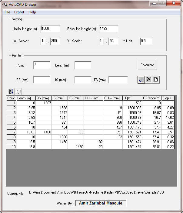
- Calculate Horizontal Profile data, slope, level and etc. from BS, IS, FS from Theodolite
- Draw Horizontal Profile accurately with all detail and tables in Autodesk AutoCAD
- Export data and result to Microsoft Excel
- Print the result
- Save, Open projects
- Edit, Insert point
This software consist of three softwares:
- AutoDrawer: Horizontal and vertical profile drawer
- Plan drawer
- Point Projector
Here, you can download small parts of this project (Horizontal and vertical profile drawer), if you need more detail and complete solution just contact me and I will give you the remaining file.
I suggest you to download Setup file, if you are not sure that you have VB runtimes.
Screenshot of the software:
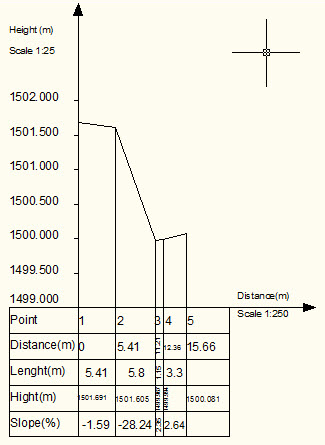
This is the Sample Result: